|
|
|
Geography of
Tibet (Xi'zang) |
|
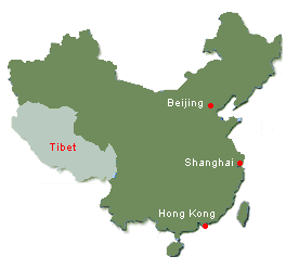
Situated in the southwest frontier of China, Tibet Autonomous Region
covers a total area of 1,220,000 square kilometres with population of
2,770,000 (2005). Standing in the southern part of Qinghai-Tibetan Plateau, the
whole autonomous region overwhelmingly comprises mountain range with an
average elevation of over 4,000 meters above sea level. With an average
of over 4,500 meters above sea level the North Tibetan Plateau occupies
two- thirds of the whole range. Basins Are surrounded by hills ranging
from 300 to 500 meters high, south of the North Tibetan Plateau, lying
between Mountain Kailash (Gangdise) and the Himalayas, stretches the
valley of Tsangpo (Yarlung Zangbo) River and its tributaries, commonly
known as South Tibetan Valley.
This valley, 4,000 metres above sea level, slops down from west to
east with Lhasa River Valley plain as its widest section. From
southern edge to China-Nepal border where Mount Qomolangms stands
upright,8848 meters above sea level, lies the Himalayas whose elevation
average 6,000 meters above sea level. To the east is the north range of
the famous Hengduan Mountains, known as East Tibetan Gully Area. Its
north section, 5,200 metres above sea level, is flat on the top; whereas
its south part, 4000 metres above sea level, abruptly falls down 2,500
meters from the top to the bottom.
The Tsangpo River, the largest in Tibet, whose upper reaches called
Tachog Khabab (Maquan River), gets water from Jiema Yangzong glacier in
the Himalayas, and stretches 2,057 kilometres before it flows into
India, where it is called the Brahmaputra River. Other large rivers such
as the Nujiang River, the Lancang River and the Jinsha River are all
full of deep falls and rapids and Tibet abounds in water resources.
The Namtso (Namco) Lake in North Tibetan Plateau is the second largest
salt water lake in China, covering an area of 1,920 square kilometres.
The Kyiring Tso (Siling Co) Lake covers an area of 1,865 square
kilometres. In addition, there are the Yardak Yumtso (Yarzhoyum Co)
Lake, Puma Yumtso Lake and Mapham Yumtso Lake. These lakes all have a
great influence on Tibetans' livelihood. |
|
|
Tibet (Xi'zang) Climate |
Tibet as a whole has plateau climate----low temperature, scanty
rainfall, thin air and plentiful sunshine. As a result of monsoon
blowing in from India, the southern Tibet is warmer and more humid. Its
average annual temperature is between -3ºC and 12ºC (26.6 ºF and 53.6
ºF). In January, the
temperature remains between -18ºC and 3.6ºC (-0.4 ºF and 38.48 ºF) and between 7ºC
and 19ºC (44.6 ºF and 66.2 ºF) in
July. Tibet is one of those areas in China that get longest time of
sunshine everyday. Lhasa and Shigats (Xigatse) both enjoy the fame of
the "City of Sunlight".
|
|
|
Brief History of
Tibet (Xi'zang) |
In ancient times, Tibet was known as Qiang or Rong and called Turpan in
the Tang (618-907) and Song (960-1280) Dynasties. In the Yuan
(1271-1368) and Ming (1368-1644) Dynasties, Tibet was
under the jurisdiction of the China central government. Tibet was divided into
U, Tsang, Kham and Ngari in the Qing Dynasty (1644-1911). The present name, Tibet,
appeared in 1663.
Tibet Autonomous Region was set up on September 9, 1956 after the
Communist Party established People's Republic of China in 1949.
|
|
|
Tibet
(Xi'zang)
Local Products |
Agriculture is well-developed in south-eastern Tibet thanks to large
rainfall, warm weather and forests. Millet, wheat, peas are the main
produce. Rice, sugar cane and bananas are grown in Loyul district.
Vegetable production has become more spread-over and experiments of
planting tobacco, tea business and sugar beets have shown remarkable
results. In animal husbandry areas, flocks of yaks, sheep and goats look
for their food everywhere. Snow leopards, bears and antelopes peer
through thick foliages.
Such precious herbs as musk, deer antlers, caterpillars and bulb of
fritillary are produced. Deposits of coal, iron, copper, borax, and
placer, natural alkaline and salt have been opened up. In addition to
Tibet's traditional handicrafts is Tibetan tweed and incense. Tibet
has established industries such as electricity, wooden textile,
chemistry, paper making, matches and construction material. Tibet is
rich in terrestrial heat. Fruits include peaches, pears, apricots and
apples. Lake teem with fish of many kinds.
|
|
|
Tibet
(Xi'zang)
Local Cuisine |
|
Traditional
Tibetan food consist mainly barley, yak and sheep meat and
some highland dairy products. As Vegetables are rare in
Qinghai Tibet Pleatau, Tsampa is the staple food of local
Tibetan. Tsampa is made of highland barley flour and chess. |
|
|
Places of Interests /Tourist Attractions of
Tibet |
|
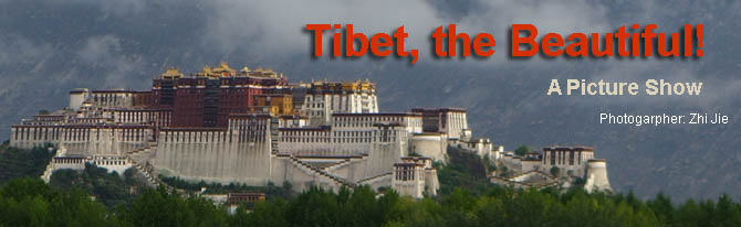
POTALA PALACE
The Potala Palace dominates the city of Lhasa from its site atop Red
Mountain (Marpo Ri). It served as a fortress and as the residence of
the Dalai Lamas, and so was the center of both political and
religious power in Tibet, remaining today an immensely popular
pilgrimage site. Divided into White and Red Palaces, the complex
rises 110 m (360 ft) high and extends 360 m (1,200 ft) across, and
was one of the world’s tallest buildings before the era of modern
skyscrapers. Rising thirteen stories and containing over a thousand
rooms and some 200,000 images, the palace complex took the work of
more than 7,000 laborers and 1,500 artists for more than fifty years
to complete. Beneath the fortress are the dungeons where those who
ran afoul of the Lamaist theocracy were imprisoned and tortured.
(More about Potala Palace)
THE JOKHANG TEMPLE
The magnificent Jokhang Temple, founded more than 1,300 years ago,
is situated in the center of Lhasa. In front of the gate stands a
stone tablet from the Tang Dynasty, bearing both Chinese characters
and Tibetan script. Nearby is the Tang willow tree planted by
Princess Wen Cheng.
DREPUNG MONASTERY
Another famous building in Lhasa is the Drepung Monastery located
six miles north of the city. Standing on a high cliff, its many
tiers leaning into a steep mountain face, the monastery is built in
traditional Tibetan style. Founded in 1416, it was one of the
centers of the "yellow hat" sect, and in its time was the largest of
the three great monasteries near Lhasa, housing 10,000 lamas. The
temples of the monastery are lavishly decorated with statues of the
Buddha, Zongkaba, and others of the Buddhist pantheon. The monastery
is still open to worshippers.
MOUNT QOMOLANGMA
Mount Qomolangma, meaning "goddess the third" in the Tibetan
language, or Mt. Everest as known in the West, is the world's
highest peak, more than 39,000 feet high.
It is everybody's wish to see the world's highest peak, of course,
but it is best to admire it from afar, and leave the climbing to the
mountaineers.
NGARI REGION
Ngari (It has different ways of transliteration, such as mNgac-ris
and Ali, etc) a miraculous district in the west of the Tibet
Autonomous Region in China, is called "the ridge on the roof of the
world". (Click for more about Ngari Region)
|
|
|
Qinghai
Tibet Railway |
|
Extending 1,956 kilometers on
the Qinghai-Tibet Plateau,
the Qinghai Tibet Railway connects, Xining, capital of
Qinghai Province, and Lhasa, capital of Tibet. The
Qinghai-Tibet Railway ends Tibet’s history without railway,
and sets a new record for the world’s highest railway. Since
its operation, the Qinghai-Tibet Railway has become one of
the busiest railways in Asia. Millions of travelers flock to
the Qinghai-Tibet Plateau to experience this great work on
the snowfields.
Tibet train is a very modern train, carrying millions of
people each year from major cities in mainland China to
Lhasa. |
|
|
Most Popular
Tibet Tour Routes |
Foreign tourists' favorite
places in Tibet are Lhasa and its surrounding areas, Shigaze
and Mt. Everest, Ngari and Mt. Kailash, Nyingchi is popluar
among Chinese domestic tourists.
Here are several popular tourist routes recommend to foreign
tourists.
Lhasa to Everest Base Camp Tour, a week to 10 days, the
tour covers most popular tourist attractions in Lhasa and
Shigatse.
Lhasa to Kathmandu Tour, a week to 9 days, travel along
1300km friendship highway between Lhas and Kathmandu in
Nepal is a classic overland journey.
Lhasa Tour, 4 days to a week, Lhasa is the spritual
center of Tibet, there is enough monasteries, mountains and
lakes to in Lhasa area. |
|
|
|
|
|
Useful Links
about
Tibet (Xi'zang) |
|
|
|
|
Tibet (Xi'zang) Related Pictures |
|
|
|
|
Related Article / Report Links of
Tibet |
|
|
|
|
|
|
|
|
|
|
|
|
|
|